The AIATSIS Map of Indigenous Australia | Flat A1
The AIATSIS Map of Indigenous Australia | Flat A1
Couldn't load pickup availability
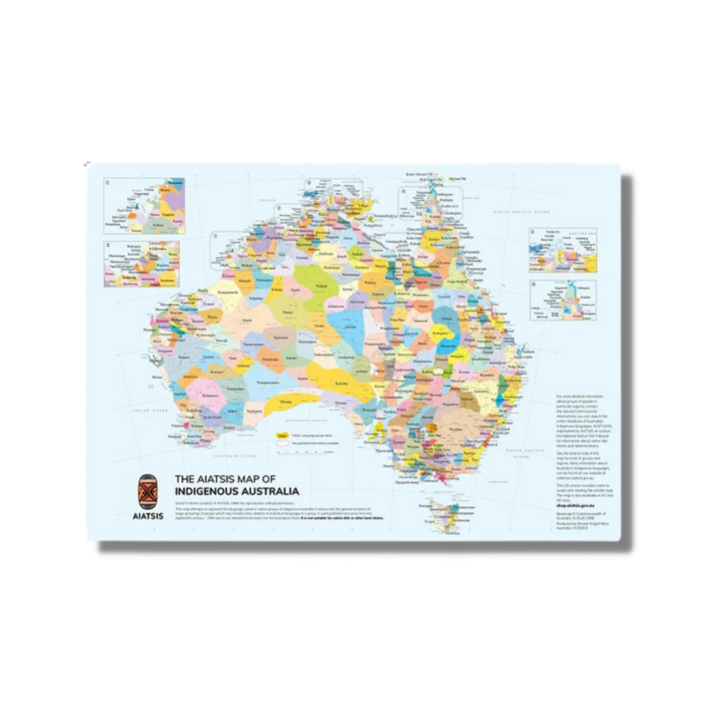
The AIATSIS map of Indigenous Australia captures the diversity of First Nations peoples, representing language, tribal, and nation groups. Inclusion on the map is based on resources from 1988 to 1994, defining cultural and trade boundaries. Indigenous peoples have occupied the continent for thousands of years, with 200+ languages at European colonisation. The map acknowledges contested information, presenting borders as intentionally blurred and approximate. It shows only the general locations of larger groupings of people which may include clans, dialects, or individual languages in a group.
Edited by David Horton the AIATSIS map of Indigenous Australia is copyright AIATSIS.
Dimensions:
The AIATSIS Map of Indigenous Australia is also available in A3 size and folded options.
Flat-rolled posters are carefully shipped in a mailing tube, with an additional postage fee of $10 if they're included with other items.